RTK Corrections · NTRIP South Africa

Centimetre-Accurate Positioning. Built for Africa.

The Osiris Protocol delivers real-time RTK GNSS corrections across South Africa through NTRIP, helping agriculture, drones, surveyors and construction teams achieve reliable centimetre-level positioning without maintaining their own base station.

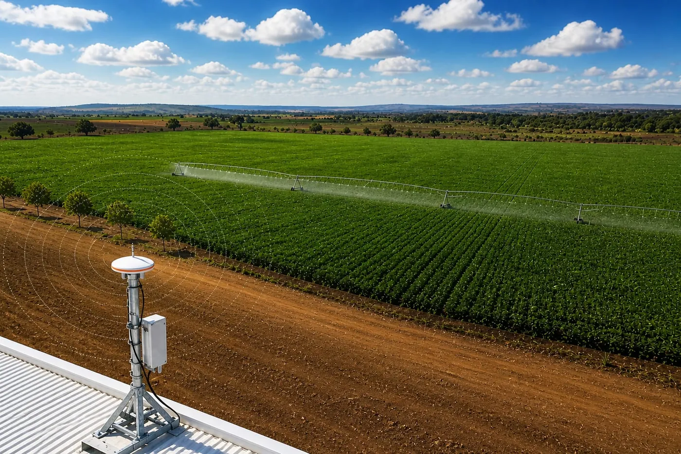
GNSS reference station on a farm roof, overlooking a centre-pivot irrigating a green crop field.
Reference station → NTRIP → your machine

Network at a glance

160+ active

Reference stations across South Africa

99.9% 24/7

Network uptime — monitored around the clock

Nationwide

Connected devices — from tractors to autonomous mowers

1–2 cm typical

Typical RTK accuracy

Technology

GPS gets you metres. The Osiris Protocol gets you centimetres.

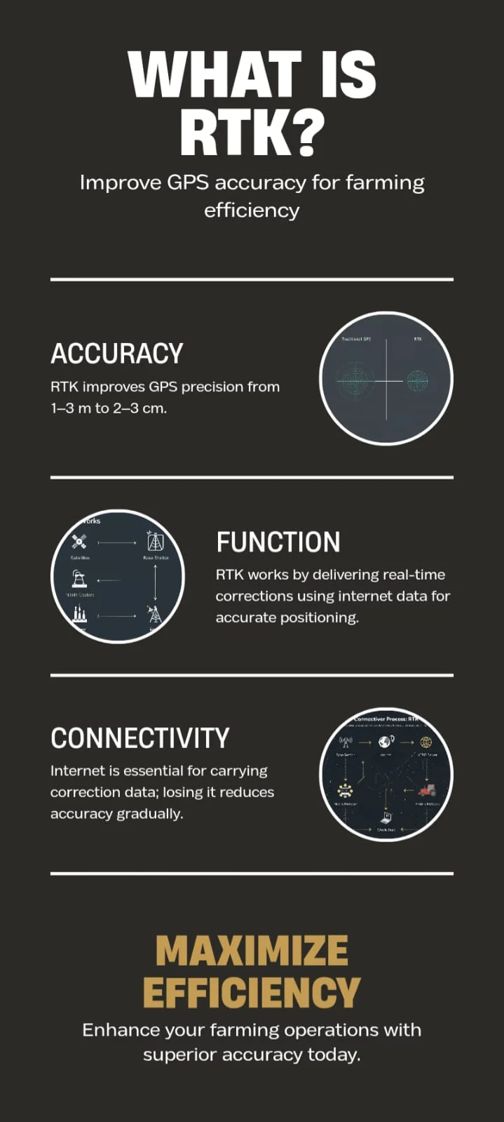
A standalone GNSS receiver estimates its position from satellite signals alone. Atmospheric delay, orbit drift and clock error leave it a few metres out. RTK removes those errors in real time by comparing your receiver against a fixed reference station of known coordinates — and sends the difference to you as a correction stream.

The Osiris Protocol network

Updated hourly
Approximate coverage zones and the regions where our clients are working. Exact station and device locations are never shown.
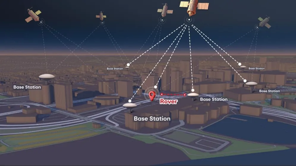
Illustration: satellites overhead, several base stations on surrounding rooftops, and a rover in the middle receiving corrections from the nearest stations.
How the network works
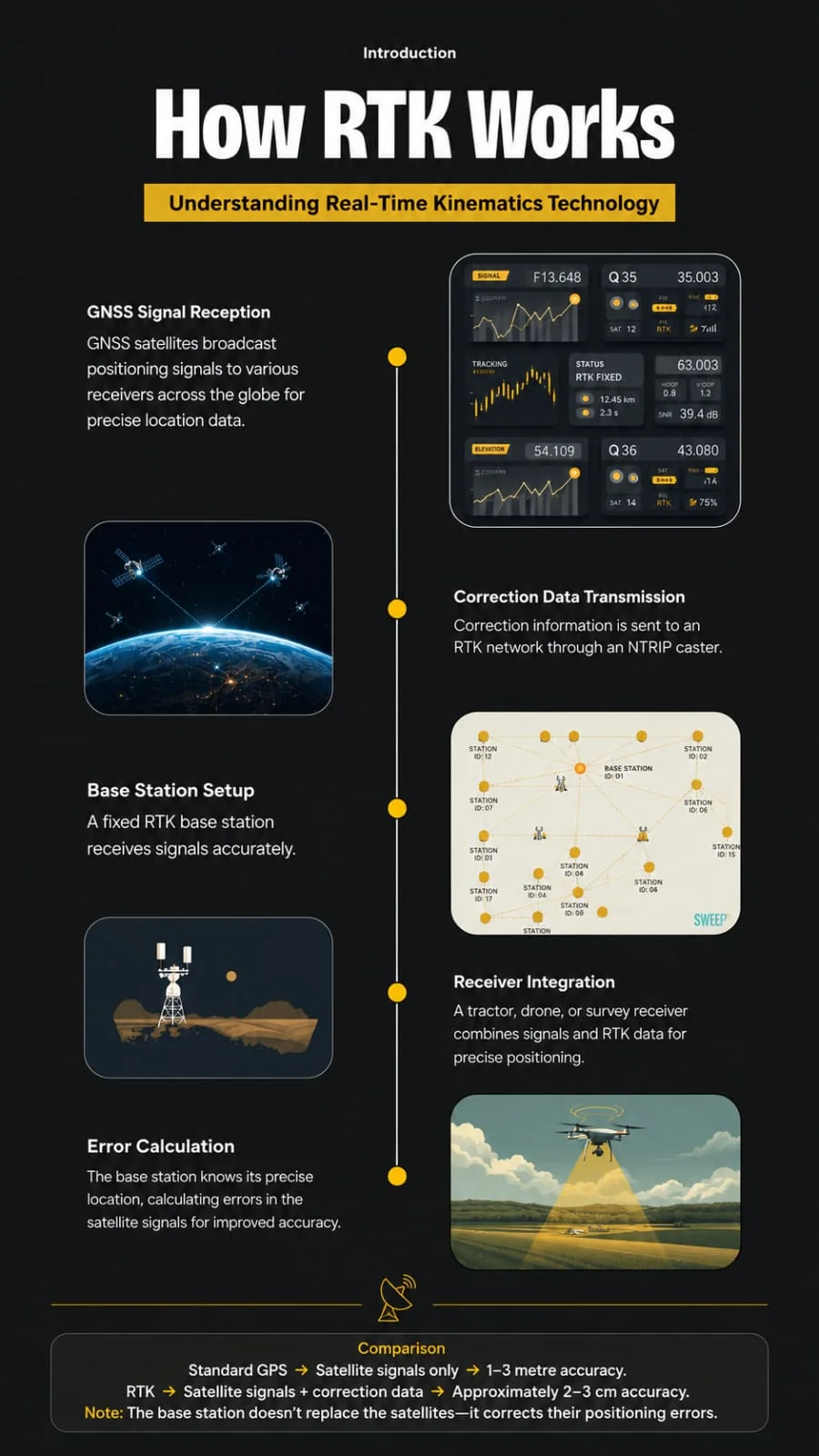
  1. Satellites broadcast GNSS signals to every receiver in the area.
  2. Base stations sit on surveyed, fixed points and measure the error in those signals.
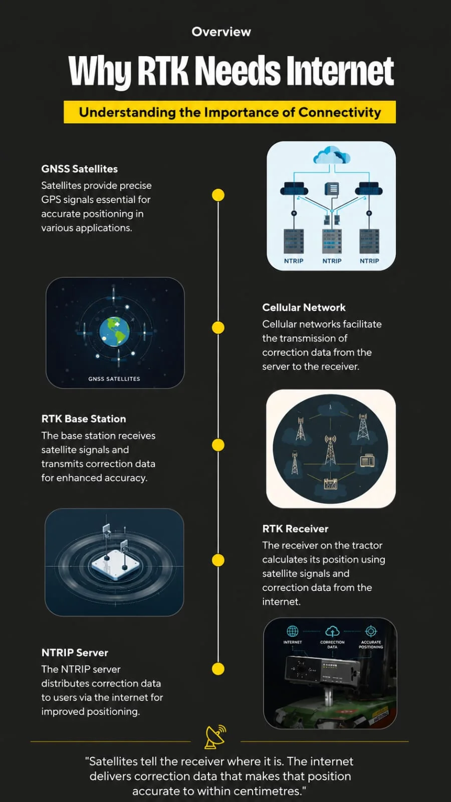
  3. The NTRIP caster streams that correction data over the internet.
  4. Your rover applies it over mobile data and resolves its position to centimetres.

The base stations don't replace the satellites — they correct their errors. That is why RTK needs a live mobile data connection in the field.

The vocabulary, in plain terms

Global Navigation Satellite Systems — GPS (US), GLONASS (Russia), Galileo (EU) and BeiDou (China). A receiver that tracks several constellations sees more satellites, fixes faster and holds a fix under trees or next to a shed wall.

Multi-constellation, multi-frequency receivers are the practical baseline for RTK work in South Africa.

RTK compares the satellite signals arriving at a reference station of precisely known coordinates with those arriving at your receiver. The shared errors cancel, and your position resolves to centimetres — in real time, while the machine is moving.

Accuracy degrades gradually with distance from the reference station, which is why network density matters more than headline numbers.

Networked Transport of RTCM via Internet Protocol. Instead of a radio link to a base station on your own farm, your receiver or controller connects over mobile data to a caster, authenticates, and subscribes to a mount point that streams corrections.

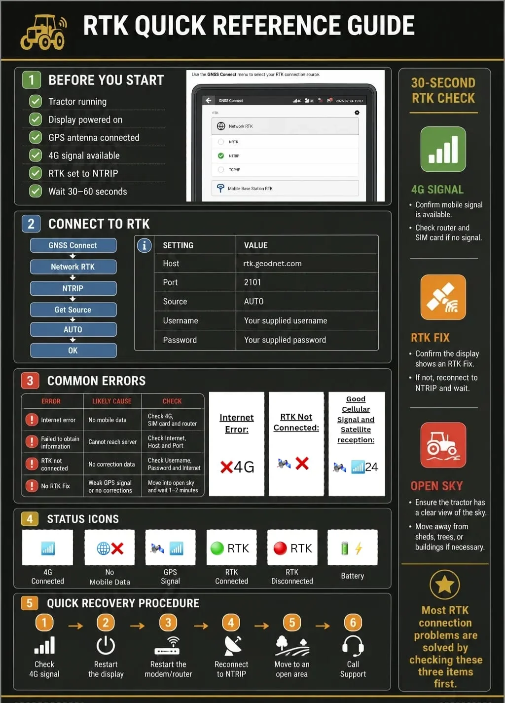
You need: caster address, port, mount point, username and password. Most modern controllers have an NTRIP client built in.

Corrections are transmitted as RTCM messages — satellite observations and reference-station coordinates, not a finished position. Your receiver does the maths locally, which is why the fix stays yours and the data volume stays small.

Typical streams run at roughly a kilobyte per second, so a month of daily field work is modest mobile data.

A base station is a receiver bolted to a known point, logging continuously. Owning one means surveying it in, powering it, securing it and maintaining it. Subscribing to a network means someone else does all of that.

A network solution also removes single-point failure: if one reference goes down, neighbouring stations carry the area.

The rover is whatever you are positioning — a tractor's guidance receiver, an RTK drone, a survey pole, a dozer blade or a tracked asset. It consumes the correction stream and outputs a corrected position to the system that needs it.

Anything with an NTRIP client and a mobile connection can be a rover.

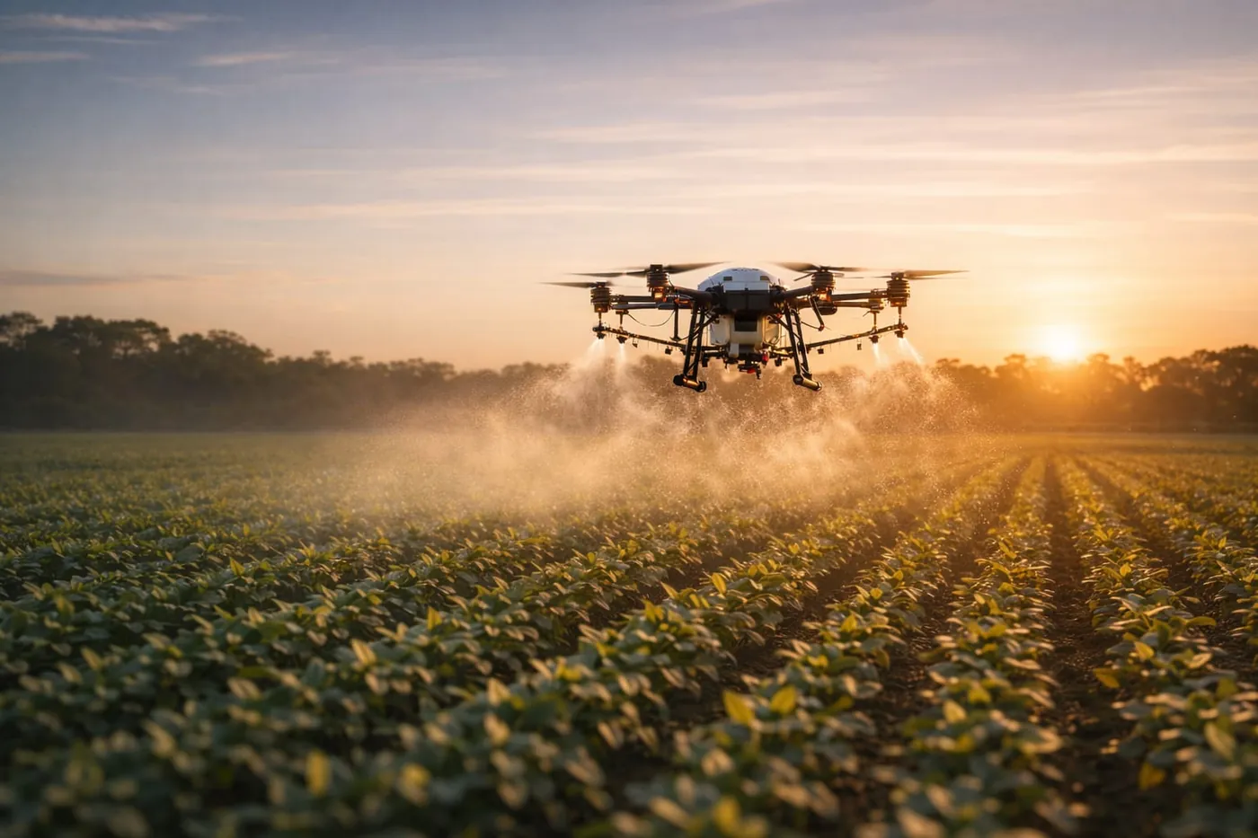
Spray drone applying crop protection over rows of young plants at sunrise.
Precision in the field

Spray lines, planting rows and pivot tracks — on one correction stream.

Industries

Working ground, not brochure ground.

Real conditions, real machines, real tolerances — from planting lines to cadastral corners.

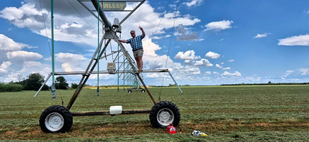
Osiris Protocol team member on a centre-pivot irrigation tower during an RTK installation.
Agriculture Row accuracy

Guidance, section control and controlled-traffic farming on centimetre lines.

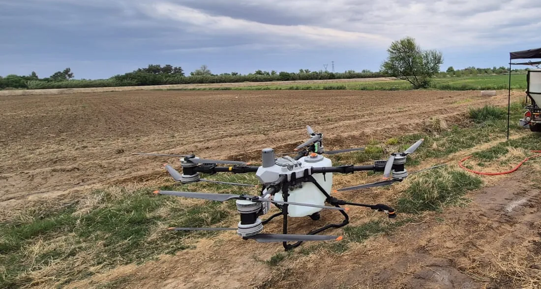
Agricultural spray drone on the ground at a field demonstration, with a mixing trailer and farmers alongside.
Drones Georeferencing

Spray and mapping drones flying RTK lines — crop protection, scouting and RTK-tagged survey imagery.

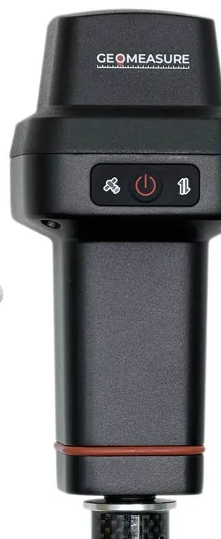
GEO-MEASURE GNSS rover mounted on a carbon survey pole.
Surveying & GIS Cadastral

Network RTK for topographic, cadastral and asset-capture work.

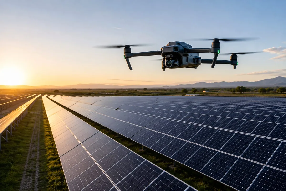
Inspection drone flying over rows of solar panels at sunset.
Energy & Infrastructure Inspection

Centimetre-tagged inspection and mapping flights over solar farms, lines and sites.

Coverage

Check coverage and talk to the team.

Tell us where you work and what you run. We'll confirm coverage for your area and set up a call or meeting at a time that suits you.

Request received

Thanks, we have your details. We'll check coverage for your area and contact you to set up a time.

Compatibility

Will my gear take our stream?

Almost certainly. Every major brand below is supported, and every installation comes with free training.

ManufacturerCategoryNTRIP / RTK supportSetup & training
TrimbleGuidance & surveySupportedIncluded
John DeereAgriculture guidanceSupportedIncluded
TopconSurvey & machine controlSupportedIncluded
Leica GeosystemsSurveySupportedIncluded
EmlidSurvey & droneSupportedIncluded
DJIDrone / RTK moduleSupportedIncluded
CHC NavigationSurvey & agricultureSupportedIncluded
Hemisphere GNSSReceiversSupportedIncluded
SeptentrioOEM receiversSupportedIncluded
u-bloxOEM modulesSupportedIncluded
AgLeaderAgriculture guidanceSupportedIncluded
Case IH / New HollandAgriculture guidanceSupportedIncluded

All listed brands are supported. Some proprietary systems need additional hardware to take an NTRIP correction stream — we'll confirm what your setup needs before installation. Every installation includes free training on the platform and your devices, and additional resources can be supplied on request.

Hardware

Receivers and stations we supply.

Ask about hardware

Already own an RTK receiver? Use the compatibility check above. Starting from scratch? We supply receivers for vehicles and survey work, reference stations that host the GEODNET network, and the telematics add-ons that go with them.

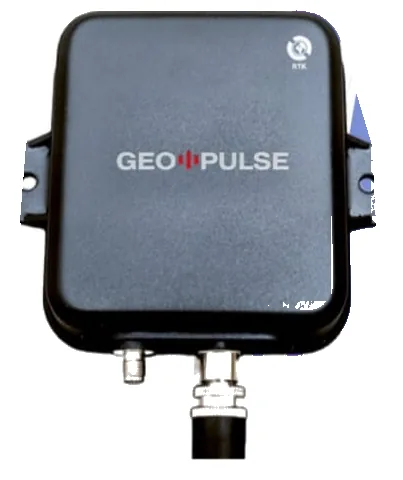
GEO-PULSE RTK receiver: black weatherproof box with mounting tabs and antenna connectors.
Vehicle · Fleet · Tracking

GEO-PULSE

Roof- or dash-mounted RTK receiver with a triple-frequency antenna and built-in IMU. Keeps tracking under canopies, bridges and through tunnels, and feeds live positions to the client portal.

RTK accuracy
< 0.1 m + 1 ppm (H)
Constellations
GPS · GLONASS · Galileo · BeiDou · QZSS
Dead reckoning
< 2 % of distance without GNSS
Convergence
RTK < 10 s
Update rate
1 Hz / 10 Hz
Connectivity
Bluetooth · Wi-Fi · iOS & Android app
Power
USB-A, < 0.9 W · < 200 g

Includes a GNSS repeater port that boosts satellite signal inside the cab for dashcams and other in-vehicle devices.
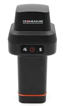
GEO-MEASURE handheld GNSS rover with power and status buttons.
Survey · GIS · Construction

GEO-MEASURE

Handheld or pole-mounted survey rover. Pair it with the GEO-MEASURE iOS app and it connects to GEODNET RTK automatically — power on, open the app, measure.

RTK accuracy
8 mm + 1 ppm (H) · 15 mm + 1 ppm (V)
Channels
Up to 1 040
Constellations
GPS · GLONASS · Galileo · BeiDou · QZSS · IRNSS
Convergence
< 5 s · reliability > 99.9 %
Battery
Up to 24 h · USB-C PD
Build
IP67 · −30 °C to +65 °C · 2 m pole drop
Weight
430 g · 5/8″ × 11 thread

Ships in a hard carry case with charging cable. NMEA-0183 output at 10 Hz.

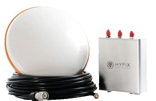
MGW200 base station kit: white dome GNSS antenna with coiled cable, and a silver receiver box with three antenna connectors.
Base station · Host the network

MGW200

Ready-to-install triple-band GNSS reference station. Mount the antenna on a roof, connect Wi-Fi, and it streams geodetic-grade data to GEODNET — strengthening RTK coverage for everyone nearby.

Receiver
Triple-band, 1 000+ channels
GPS / QZSS
L1C/A · L1C · L2P(Y) · L2C · L5
Galileo · GLONASS
E1 · E5a · E5b · L1 · L2
BeiDou
B1I · B2I · B3I · B1C · B2a · B2b
Upload
2.4 GHz Wi-Fi · web setup page
Power
< 2 W, USB-C · no RF emissions
Size
4.0 × 3.5 × 1.2″ · 1 lb

Optional built-in NTRIP server for private local RTK. Per the manufacturer, it mines GEOD tokens on the GEODNET network.

Resources

Answers, straight.

The knowledge centre is built to answer the questions people actually type — and the ones assistants get asked on our behalf.

Frequently asked questions

RTK (real-time kinematic) is a GNSS technique that corrects satellite positioning errors in real time using observations from a fixed reference station, taking accuracy from metres to centimetres.

Well-configured RTK typically delivers horizontal accuracy of one to two centimetres and vertical accuracy roughly twice that, subject to satellite visibility, baseline distance to the reference station and the quality of the receiver.

GPS is one satellite constellation; RTK is a correction method applied on top of GNSS signals. A plain GPS position is a standalone estimate, metres wide. An RTK position is that estimate with the atmospheric, orbital and clock errors removed.

RTK corrects in the field, in real time, so the machine or operator acts on a centimetre position immediately. PPK corrects afterwards in processing. Choose RTK for guidance, machine control and staking; PPK is a fallback where live connectivity is impossible.

No. That is the point of a correction network — you subscribe to a stream instead of buying, surveying in, powering and maintaining your own reference receiver.

Your receiver or controller opens an authenticated connection over mobile data to an NTRIP caster, subscribes to a mount point, and receives RTCM correction messages continuously while it works.

It depends on reference-station proximity and mobile coverage at the site. Use the coverage check above and we will confirm against the network register rather than guess.

A GNSS receiver capable of RTK with an NTRIP client, a mobile data connection at the work site, and credentials for a mount point. Most current agriculture, drone and survey hardware already qualifies; some proprietary systems need additional hardware, which we supply. Every installation includes free training on the platform and your devices.

Get to know the team

Farm roots. Field-tested technology.

Portrait of Eduard Esterhuizen, co-founder of The Osiris Protocol.
Eduard Esterhuizen Co-founder
Portrait of Lisa Walker, co-founder of The Osiris Protocol.
Lisa Walker Co-founder

About The Osiris Protocol

The Osiris Protocol is a South African IoT consultancy focused on precision agriculture, GNSS technology and operational intelligence. We help farmers and businesses improve positioning accuracy, asset visibility and operational efficiency through practical technology solutions.

Through TOP RTK services, we provide access to high-precision GNSS correction data for compatible equipment and applications. Our work combines precision positioning, connected devices and data integration to support smarter agricultural operations and more informed decision-making.

Our history & team

Founded in 2024 by Eduard Esterhuizen and Lisa Walker, The Osiris Protocol was built on a shared agricultural background and a passion for innovation. With a deep understanding of the challenges faced by the agricultural community, we are committed to making agricultural technology more accessible, practical and affordable.

Our mission is to bridge the gap between traditional farming and modern technology, empowering local farmers and businesses with solutions that improve efficiency, precision and long-term sustainability.

We believe technology should deliver measurable value in the field: improving efficiency, enabling more precise operations and supporting sustainable, future-focused farming.